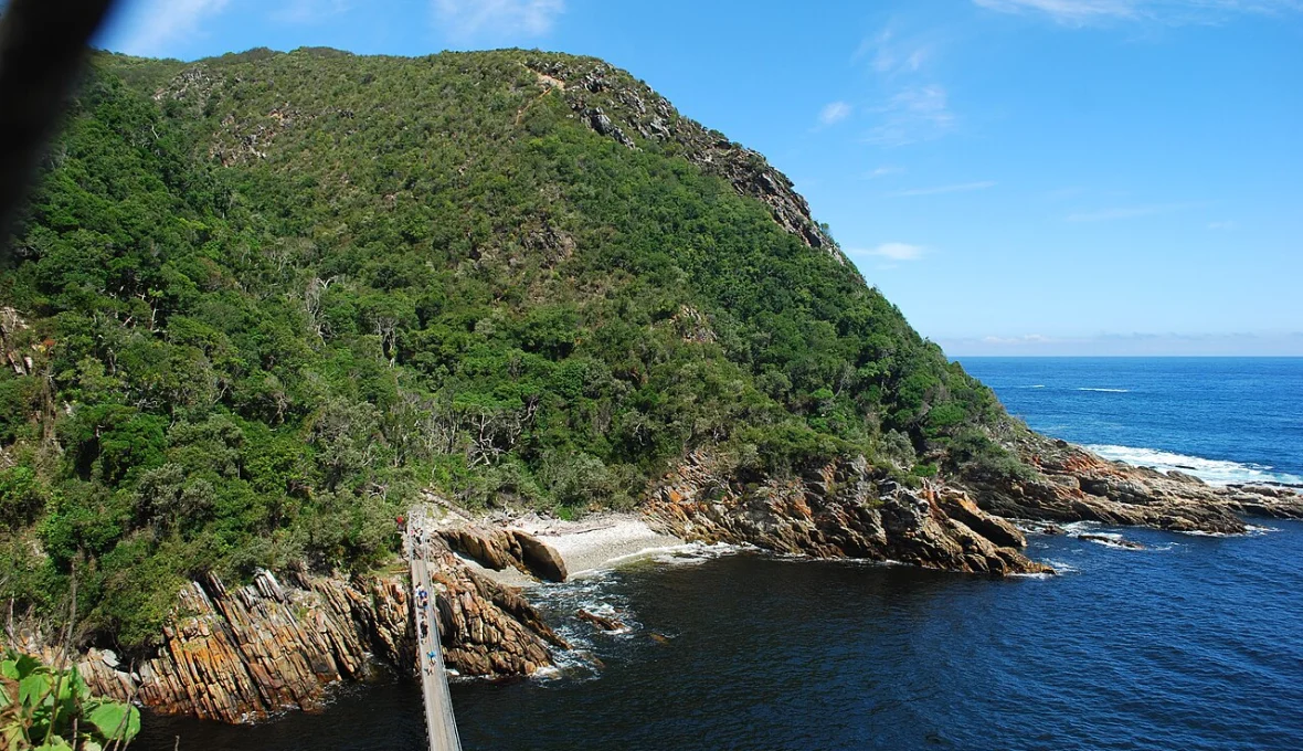
The Garden Route is more than a drive between coastal towns. Its national park includes forest, rivers, lakes and shoreline, with walks ranging from a short boardwalk to a demanding coastal route. These ten SANParks trails offer different starting points for planning an outing in the Wilderness, Knysna and Tsitsikamma sections.
How we selected these 10
EBNewsDaily selected a mix of routes described by SANParks, considering setting, variety and planning usefulness. The numbering organises the guide; it is not a measured ranking. This is desk research, not a claim that we walked or tested the routes. SANParks’ trail information and notices were checked on 3 November 2026. Conditions and access change, so inclusion does not confirm a trail is open today. No paid placement was accepted.
At a glance
| Walk | Area | Character |
|---|---|---|
| Mouth Trail | Tsitsikamma | Forest and river mouth |
| Loerie Trail | Tsitsikamma | Short forest and coastal views |
| Blue Duiker Trail | Tsitsikamma | Longer forest loop |
| Waterfall Trail | Tsitsikamma | Rocky coastal hike |
| Goesa Nature Walk | Storms River Village | Indigenous forest |
| Ratel Trail | Tsitsikamma forest | Colour-coded forest routes |
| Woodville Big Tree walk | Wilderness area | Forest and yellowwood |
| Half-collared / Giant Kingfisher | Wilderness | River and forest |
| Cape Dune Mole-Rat Trail | Wilderness lakes | Sandy paths and lake views |
| Perdekop Trail | Harkerville | Forest circuit |
1. Mouth Trail
The Mouth Trail at Storms River Mouth connects coastal forest with the river mouth and its suspension bridge. SANParks describes a boardwalk through indigenous forest, with an option to continue towards a higher lookout. It is a good introduction to the dramatic meeting of forest, river and sea, but a boardwalk can include steps and should not automatically be assumed suitable for every mobility need. Check the specific route and current conditions with the park. SANParks reported the trail and bridge reopened after severe weather in May 2026; that historical notice is not a guarantee that they are open on your travel date. See SANParks’ trail guide.
2. Loerie Trail
The Loerie Trail is a short option at Storms River Mouth for visitors who want a taste of the coastal forest without committing to a long hike. SANParks describes a route through forest, with a climb to the Agulhas lookout area and a stretch of fynbos. Its published distance is about one kilometre, but short does not necessarily mean flat or accessible to everyone. Check the starting point, steps and current surface before choosing it for children or anyone with limited mobility. Allow extra time for stops and changing weather, and use marked paths rather than venturing into the vegetation. Read the route description.
3. Blue Duiker Trail
SANParks describes the Blue Duiker as a longer forest circuit than the Loerie, passing through indigenous forest and ending near the start of the Otter Trail. It is a way to spend more time under the forest canopy while still planning a day walk rather than an overnight trip. The park’s guide gives an approximate distance of 3.7 kilometres; ask staff about the currently usable route and expected duration for your group. Bring drinking water and shoes appropriate for uneven or damp ground. The trail name refers to a forest antelope, but wildlife sightings are never guaranteed. Check SANParks’ listing.
4. Waterfall Trail
The Waterfall Trail follows the first section of the better-known Otter Trail along Tsitsikamma’s rocky coast. SANParks describes a return walk to a waterfall and rates the route as fairly strenuous, with caution needed around high tides. It is best suited to walkers comfortable with uneven coastal terrain rather than a group looking for a paved promenade. Check current access, tide and weather information with the park before starting; do not assume a route that was open on a previous visit remains safe. Leave adequate daylight for the return and turn back if conditions or the group’s ability make the walk unsuitable. Review the coastal route.
5. Goesa Nature Walk
The Goesa Nature Walk starts and ends at the forestry office in Storms River Village, according to SANParks, and passes through indigenous forest. The park lists it as a two-kilometre walk. Its village starting point makes it a different choice from trails beginning inside the Storms River Mouth rest camp, so confirm the correct entrance before setting out. SANParks has introduced conservation-fee arrangements for the Goesa and nearby forest access points; check the current payment and permit rules directly. Forest paths can be wet or obstructed after rain, so confirm the route is open and wear footwear suited to the day’s conditions. Garden Route park notices.
6. Ratel Trail
The Ratel Trail gives visitors a choice of colour-coded routes in the Tsitsikamma forest. SANParks lists a short green route using a boardwalk to the Big Tree, alongside longer yellow and red options. That makes it useful for a group deciding how much time and walking effort to commit, although different routes and boardwalk sections may have different accessibility characteristics. Check signs and a current map at the entrance before following a colour, and confirm the applicable conservation fee. Keep to the designated path around tree roots and forest vegetation, and do not treat an old trail map as proof that all loops are open. See route options.
7. Woodville Big Tree Circular Walk
Near the Wilderness area, the Woodville walk is organised around a large yellowwood in indigenous forest. SANParks describes it as a relatively short circular outing, making it an appealing choice for visitors who want a forest experience without an all-day trek. The pleasure lies in slowing down to notice the canopy and the vegetation rather than rushing to a viewpoint. Before travelling, confirm the entrance, road conditions and route suitability with park staff, particularly after heavy rain. A short circular route still requires sensible shoes and enough time to complete it safely before the relevant gate or facility closes. Read SANParks’ description.
8. Half-collared and Giant Kingfisher trails
In the Wilderness section, SANParks describes the Half-collared and Giant Kingfisher trails along the Touw River, through shaded forest towards a waterfall. Its trail guide mentions a pontoon crossing connecting sections; water levels and the condition of any crossing are important details to verify before leaving. This is a longer outing than a brief roadside walk, so consider the whole group’s fitness and allow time for the return. Carry water and a waterproof layer, and check for flood or trail notices. Bird names suggest what might live in the area, not a guarantee of sightings during a visit. Check the Wilderness trails.
9. Cape Dune Mole-Rat Trail
This Wilderness lakes-area route passes through different vegetation types, with sandy sections and views over parts of the lake system. SANParks describes shorter and longer loop options, giving walkers a way to choose an outing around the time and energy available. Sand can make walking more tiring than the distance alone suggests, especially in heat. Confirm the current starting point, route marking and access before travelling, and bring water and sun protection. Take particular care around sensitive dunes and vegetation: the purpose of the trail is to experience the landscape while leaving it intact for other visitors and wildlife. View SANParks’ trail information.
10. Perdekop Trail
In the Knysna section, SANParks describes Perdekop as a circular forest route starting at the Harkerville forestry station. Its published route is longer than the short boardwalk options in this guide, so plan it as a proper day walk with suitable footwear, water and a current map. Parts share paths with the Harkerville coastal hiking route, making attention to signs important. SANParks has reported weather-related disruption and changes to some Harkerville activities in 2026; check the specific Perdekop route and access with the park before travelling. Do not assume that a neighbouring route’s status applies to this circuit. Read the Perdekop listing.
Before you choose
Contact SANParks for the latest route status, fees, permits and local weather. Flooding, fire, high seas or maintenance can close routes at short notice. The park’s published trail page identifies the Salt River via Keurpad route as closed following floods; it is not included in this selection. Share your route and expected return time with someone, carry water and suitable clothing, and select a walk that matches the least experienced person in your group.
Sources and updates
Checked 3 November 2026 against the SANParks walking guide, park notices and its May 2026 severe-weather update. Confirm current conditions with the park. Featured image: Storms River suspension bridge in 2016. Photo: Rob Koster / Wikimedia Commons, CC BY-SA 4.0; resized from the original.